
Big Coppitt, Rockland and Geiger Key seawall repair
On Big Coppitt, the county has designed a project to raise 19 streets, which will change how your seawall cap compares with the road. Monroe County permits seawall work here and on Rockland, Geiger and the Saddlebunch Keys.
Describe your project on this page ↓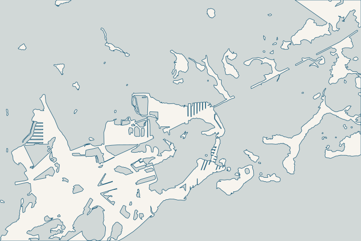
Big Coppitt, Rockland & Geiger Key at a glance
- Who permits it
- Monroe County; all four keys are unincorporated
- Call first
- County Stock Island office, (305) 295-3990
- Road project
- 19 Big Coppitt roads designed to a 2.26-foot NAVD88 minimum
- The water
- 14 Big Coppitt canals (779 parcels); 20 oceanside Geiger canals (462)
- Storm record
- Wilma storm tides of 5 to 8 ft above MSL from Boca Chica to Big Pine
Get to know your waterfront
Big Coppitt is an unincorporated census place whose canals sit at mile markers 10 and 11, with Rockland, Geiger and the Saddlebunch Keys nearby, all county land. Big Coppitt’s 14 canals are mostly bayside, while all 20 of Geiger Key’s canals sit on the ocean side. The county calls Big Coppitt Hot Spot 2 for 2040 sea-level rise and high tide flooding, and has designed a road elevation project for 19 of its streets.
2020 Census Gazetteer Files: Places, Florida · Monroe County Residential Canals (Google Earth KMZ layer 'Residential_Canals_WGS', linked as 'Google Earth Document with Downloaded Canal Information') · Monroe County Vulnerability Assessment Update & Compliance, Final Project Report (DEP Agreement No. 22PLN66) · Big Coppitt Road Elevation & Resiliency Adaptation Project
Road elevation, canals and rock: Big Coppitt to Saddlebunch
On Big Coppitt, the street beside your seawall is designed to rise. The county project covers 19 roads from Riviera Drive east to 1st Street. Sections go up by as much as 18 inches, to a 2.26-foot NAVD88 minimum. County Big Coppitt project page
The road project, piece by piece
- Three linked pump stations, at Puerta Drive, Prado Circle and the north end of 4th Street, plus inlets and injection wells. County Big Coppitt project page
- Final plans went to the state on May 27, per the county’s June 2026 update. The design estimate is $85,867,616, with $84.5 million in grants if the project passes FEMA’s benefit-cost test. County Big Coppitt project page County Big Coppitt project page
- Inlet easements on private lots are voluntary, and owners will vote on a yearly assessment to run the pumps. County Big Coppitt project page
- The county shows 2025 flooding on 5th Street and Avenue C. It explains that rising seas push groundwater up until drainage trenches cannot empty. County update, Feb. 2026
The project raises roads, not seawalls, and private wall rules stay the same. County Big Coppitt project page A cap left below the new street grade is a question for you and your engineer. County Big Coppitt project page
Find your canal, Big Coppitt to Saddlebunch
| Area | Canals | Parcels | Streets |
|---|---|---|---|
Big Coppitt | 436 to 449 (12 bayside, 2 oceanside) | 779 | Canal 437: Barcelona, Puerta, Riviera and Verde Drives, Del Mar Blvd and nearby lanes. Canals 436-446: Jade, Aquamarine, Diamond, Sapphire, Emerald, Tamarind, Cactus and Palmetto Drives. Canal 442: Ed Swift Rd. Canal 449: Shore Ave and Ter, Coppitt Rd, 5th St. |
East Rockland Key | 450 (bayside) | 36 | Calle Uno and Calle Dos |
Geiger Key | 452 to 476 (all oceanside) | 462 | Bird lanes such as Macaw, Tern, Ibis and Egret; star lanes such as Mars, Venus, Vega and Sirius; Boca Chica Rd; Geiger Rd |
Saddlebunch Keys | 432, 433 and 435 (oceanside) | 138 | Bay, Boulder, Beach, Palm, Shore and Blue Water Drives |
Canal sources: County canal inventory County canal street list County canal inventory County canal street list County canal street list County canal inventory County canal street list Tide range fields run about 0.8 to 1.3 ft on Big Coppitt and drop to about 0.4 ft at Saddlebunch.
Geiger Key’s canals are mid-repair
Twelve of Geiger Key’s 20 canals carry a “Poor” water-quality label. County canal inventory The county finished a $1.6 million culvert at canal 475 in February 2024. FloridaCommerce Keys oversight report
More is queued. In 2024 the county asked for $230,000 to design muck removal, backfilling and air curtains for canals 470, 472, 474, 475 and 476. County 2024 Stewardship requests On the 2021 draft ranking, canal 474 placed 8th and 472 placed 14th. 2021 county canal ranking On Big Coppitt, canal 443 ranked 35th, with backfill alone recommended. 2021 county canal ranking
Saddlebunch: hard rock and a low road
- Bay Drive, in the Bay Point Amended Plat, is first on the county’s initial list of its most critical roads. County critical roads list
- USGS cores at the Saddlebunch Keys found oolite topped with several inches of calcrete, some of the thickest crust in the Keys. Ask for a rock probe before anyone prices driven sheet pile. USGS Professional Paper 1751
- Wilma flooded U.S. 1 in the Saddlebunch Keys and washed several medium to large boats ashore. NWS Key West Wilma summary
Across this whole stretch, NWS estimated Wilma’s storm tides at 5 to 8 ft above MSL between Boca Chica and Big Pine. NWS Key West Wilma summary For toe protection on a wall that faces open water, see riprap and shoreline stabilization.
What could the work cost?
Ask each bidder to price rock conditions, barge access and toe riprap as separate lines, since hard crust and long oceanside canals can change the method. If you live in the road project area, get your cap elevation surveyed before the street rises.
Calculator ranges come from a 2026 national cost guide and one Key West public bid. None is a quote; your written, itemized scope sets your price.
Compare quotes and plan a budget →Find the relevant permits and records
| Starting point | What to resolve | Prepare and look up |
|---|---|---|
Monroe County Building Department | Building permits for seawall, riprap and dock work on Big Coppitt, Rockland, Geiger and the Saddlebunch Keys. | Register on OPAL; paper is not accepted. Nearest office: Stock Island, (305) 295-3990. |
Monroe County Planning & Environmental Resources | Review under county code 118-12, including the ban on new vertical seawalls on open water. | Show whether the wall faces a manmade canal or open water. Environmental Resources: (305) 289-2502. |
Florida DEP Marathon branch | Exemptions and general permits, including riprap at the toe of an existing seawall. | Toe riprap must be no steeper than 2:1, reach no more than 10 ft out and use boulders 1 to 3 ft across. (305) 289-7070. |
Army Corps Keys Permits Section and the sanctuary | Federal authorization, plus sanctuary review where seawall or riprap work could affect corals. | Corps (305) 526-7181. Submit to the sanctuary at least 90 days before you want to start. |
A Big Coppitt and Geiger Key checklist
Do these before the road work starts or a contractor quotes your wall.
Survey your cap in NAVD88
Ask a surveyor for your cap and yard elevations in NAVD88, the datum the road project uses. Then you can compare them with the new street grade.
Ask before signing an easement
If the county asks for a voluntary inlet easement on your lot, ask where the inlet and pipe will sit relative to your wall and drains.
Ask how bidders will handle the rock
Near Saddlebunch, ask each bidder how they will deal with calcrete crust, and whether a probe or boring is included.
Check the Geiger canal queue
Owners on Geiger canals 470 to 476 can ask the canal program at (305) 453-8774 when design and construction are expected.
Water Quality Protection and Canal Restoration in the Florida Keys ACSC: DEP Stewardship Funding Portal Project Requests · Canal Restoration
Plan your Big Coppitt or Geiger Key seawall
Tell us your street and canal, whether the road project reaches you and what you see at the cap. We will help you line up the next move.
Every answer here links to the public record behind it.
Big Coppitt, Rockland & Geiger Key project questions
Will the Big Coppitt road project raise my seawall?
No. The county project raises 19 roads and adds pump stations and injection wells, and it leaves private seawall rules unchanged. Inlet easements are voluntary, and owners will vote on a yearly pump assessment. A cap below the new road grade is a question for you and your engineer.
Is Rockland Key part of Key West?
No. The City of Key West lists Rockland Key among areas with Key West mailing addresses that sit outside the city, so Monroe County permits the work. The county inventory shows one residential canal there, canal 450, on Calle Uno and Calle Dos.
Floodplain Management (FEMA) · Monroe County Residential Canals (Google Earth KMZ layer 'Residential_Canals_WGS', linked as 'Google Earth Document with Downloaded Canal Information') · Canal, Roads Names and Areas (List of Keys Residential Canals by location)
Which canal is my Geiger Key street on?
The county ties Geiger’s canals, numbered 452 to 476, to its bird-named and star-named lanes plus Boca Chica Road and Geiger Road. One street can touch several canals, so confirm your parcel on the county map.
Canal, Roads Names and Areas (List of Keys Residential Canals by location) · Monroe County Residential Canals (Google Earth KMZ layer 'Residential_Canals_WGS', linked as 'Google Earth Document with Downloaded Canal Information')
Why does rock matter more near Saddlebunch?
USGS cores there found oolite capped by several inches of calcrete, some of the thickest crust in the Keys. Crust that hard can make driving sheet pile harder. Ask for a probe or boring before choosing a wall type.
Keep planning
Nearby waterfront guides
Stock Island, Sugarloaf Key & Sugarloaf Shores, Key Haven (Raccoon Key)
Show sourcesHide sources
- 2020 Census Gazetteer Files: Places, FloridaSource reviewed 2026-10-28
- Monroe County Residential Canals (Google Earth KMZ layer 'Residential_Canals_WGS', linked as 'Google Earth Document with Downloaded Canal Information')Source reviewed 2026-10-28
- Monroe County Vulnerability Assessment Update & Compliance, Final Project Report (DEP Agreement No. 22PLN66)Source reviewed 2026-10-28
- Big Coppitt Road Elevation & Resiliency Adaptation ProjectSource reviewed 2026-10-28
- February 2026 Updates Presentation (Monroe Resilience & Environmental Projects)Source reviewed 2026-10-28
- Canal, Roads Names and Areas (List of Keys Residential Canals by location)Source reviewed 2026-10-28
- Florida Keys Area of Critical State Concern Annual Report, FY23-24 (reporting period July 1, 2023 - June 30, 2024)Source reviewed 2026-10-28
- Water Quality Protection and Canal Restoration in the Florida Keys ACSC: DEP Stewardship Funding Portal Project RequestsSource reviewed 2026-10-28
- Monroe County Canal Restoration Ranking List (dated 06/16/2021; page footer 4/12/2021)Source reviewed 2026-10-28
- Appendix K: Prioritization of Roadway Segments (Technical Memorandum, Dec. 29, 2020; Initial 25% Critical Roadways list dated 6/10/2021)Source reviewed 2026-10-28
- Saddlebunch Keys - Tile 6 (Professional Paper 1751)Source reviewed 2026-10-28
- Hurricane Wilma (2005) event summarySource reviewed 2026-10-28
- Online Permitting ServicesSource reviewed 2026-10-28
- Building and PermittingSource reviewed 2026-10-28
- Environmental ResourcesSource reviewed 2026-10-28
- Monroe County Land Development Code, Chapter 118 - Environmental ProtectionSource reviewed 2026-10-28
- SED Marathon OfficeSource reviewed 2026-10-28
- Rule 62-330.431, F.A.C. (General Permit for Installation of Riprap)Source reviewed 2026-10-28
- Jacksonville District Regulatory Office LocationsSource reviewed 2026-10-28
- Nearshore Construction PermitsSource reviewed 2026-10-28
- PermitsSource reviewed 2026-10-28
- Canal RestorationSource reviewed 2026-10-28
- Floodplain Management (FEMA)Source reviewed 2026-10-28