Summerland Key seawall repair and permits
Summerland Key’s road area 42-A scored 5.00, the top criticality in Monroe County’s road study, and sits in its 2025 adaptation group. For canal owners nearby, the seawall cap and the street are one planning question.
Describe your project on this page ↓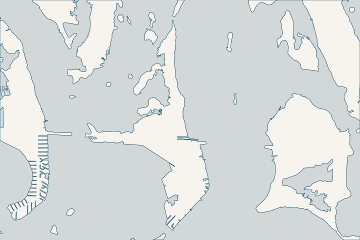
Summerland Key at a glance
- Who permits it
- Monroe County, not a city building department
- Call first
- County Marathon office, (305) 289-2501
- The water
- 13 canals, 11 oceanside, 634 parcels
- Storm record
- Georges 1998: 5 to 6 ft surge; Irma 2017 topped seawalls in USGS photos
- Roads to watch
- Area 42-A scored the top road criticality, 5.00
Get to know your waterfront
Summerland is a compact key at mile markers 24 and 25. The county lists 13 residential canals here, 11 of them oceanside, serving 634 parcels along about 15,250 feet. The same short stretch holds Summerland Airfield and private marinas that the county flags as a long-term sea-level-rise hot spot.
Monroe County Residential Canals (Google Earth KMZ layer 'Residential_Canals_WGS', linked as 'Google Earth Document with Downloaded Canal Information') · Monroe County Vulnerability Assessment Update & Compliance, Final Project Report (DEP Agreement No. 22PLN66)
Summerland Key seawall checks, street by street
Thirteen canals share two mile markers here, so the canal number is the fastest way to find your records. County residential canal layer
Summerland canals by street
| Canal | Streets on the county list |
|---|---|
351 | Airport, Bay, Caribbean, Flagship, Gulf, Lagoon, Park and Lake Drives; Isles Blvd |
356 to 361 | 1st, 2nd, 3rd and 4th Streets |
328 | Dobie and Henry Streets |
381 to 383 | Calle Bogota, Calle Colombia, Calle Real and Ocean Dr |
A street can touch more than one canal, so check your parcel on the county map. County canal street list
Road area 42-A and the 2025 group
Area 42-A covers Summerland Key Cove Amended, its 1st and 3rd Additions, and Summerland Estates Resubdivision No. 2. It is only 1,119 feet of road, yet it scored 5.00, the top criticality in the study. County road study, Table 2
Summerland Yacht Harbor and Snug Harbor, area 40, follow in the 2035 group. In all, Summerland has 22 segments on the critical list, including 1,040 feet of Caribbean Drive West with 29 residential units. County critical roads list
A raised street beside your canal can change where rainwater and high tides go. Ask your engineer to check cap height and drainage against the county plan before you replace.
What Irma and Georges did on Summerland
- Irma, 2017: a USGS before-and-after photo pair shows surge topping the seawall in front of Summerland homes and moving sand both landward and seaward of the walls. USGS Irma photo comparison
- Irma’s reach: The Hurricane Center put inundation for portions of the Lower Keys from Cudjoe east to Big Pine, a stretch that includes Summerland, at 5 to 8 feet above ground. Hurricane Center Irma report
- Georges, 1998: Summerland saw a surge of 5 to 6 feet, per NHC. Hurricane Center Georges report, Table 2
Water that tops a wall can pull fill out from behind it as it drains back. After any storm, walk the cap line for sinkholes, soft ground or new gaps, then read the soil loss and drainage page.
Airfield, marinas and the Shore Drives
The county’s vulnerability study names Summerland as Hot Spot 7, with sea-level-rise impacts projected for 2070 to 2100. It lists West and East Shore Drives, FKAA lift stations SKI-501 through SKI-511, Summerland Airfield and private marinas, including Blanche Bergin Marina Park and Summerland Cove. County vulnerability assessment
On open-water lots, the county allows a lawful existing wall to be repaired or replaced in about the same footprint, but no new vertical wall. county code 118-12(k)(3) county code 118-12(k)(4) Because the code favors native vegetation or riprap with filter cloth, price riprap as well.
Canal projects
The 2021 ranking listed canal 328, on Dobie and Henry Streets, 34th for a $100,000 weed gate. Canal 323 ranked 36th for organic removal, backfill and a weed gate, at about $4.5 million. Both are public water-quality figures, not seawall prices. County canal ranking list, 2021
For the keys on either side, see the Cudjoe Key and Ramrod Key guides, or the Lower Keys overview. The permit guide covers the full county, state and federal path.
What could the work cost?
On Summerland, ask each bidder what cap elevation they are pricing and whether it fits the county’s road plans for your block. Have them list cap, toe, backfill and drainage as separate prices so the quotes compare like for like.
Calculator ranges come from a 2026 national cost guide and one Key West public bid. None is a quote; your written, itemized scope sets your price.
Compare quotes and plan a budget →Find the relevant permits and records
| Starting point | What to resolve | Prepare and look up |
|---|---|---|
Monroe County Building Department, Marathon office | Building permit for seawall, dock and riprap work on Summerland Key, which is county land rather than a city. | Register in OPAL and upload signed drawings; paper is not accepted. Marathon office: 2798 Overseas Hwy, Suite 300, (305) 289-2501, 8:30 a.m. to 3 p.m., appointments recommended. |
Monroe County Planning & Environmental Resources | Shoreline review under county code 118-12, and in V or Coastal A flood zones, a design professional’s flood analysis. | Ask your engineer for the county code 122-31(d) analysis showing the wall will not push floodwater or waves onto neighbors. Planning: (305) 289-2529. |
Florida DEP, Marathon branch | State exemption verification, and any mangrove trimming tied to the wall. | Before trimming mangroves that grow into the wall, send DEP a description and photos. (305) 289-7070. |
U.S. Army Corps of Engineers, Keys Permits Section | Federal authorization, which the county requires before its Notice to Proceed. | Apply to SEAppls@usace.army.mil or call (305) 526-7181. Budget $976 for the county Notice to Proceed once approvals are filed. |
Before you call a Summerland bidder
These steps take an afternoon and make every quote easier to judge.
Match your street to a canal
Use the street table on this page, then confirm on the county’s Residential Canals map file, which also shows depth and ranking.
Canal, Roads Names and Areas (List of Keys Residential Canals by location) · Canal Restoration
Ask about road areas 42-A and 40
In Summerland Key Cove, Summerland Estates, Summerland Yacht Harbor or Snug Harbor, find out where the road plan stands before setting a cap height.
Monroe County Roadway Vulnerability Study Final Report (Table 2: Adaptation Plan List)
Photograph king tides at your wall
The county expects king tides from September through December and collects flood photos. Email dated pictures of water at your cap to greenkeys@monroecounty-fl.gov.
Order the flood analysis early
In V or Coastal A zones, the county wants a design professional’s analysis with the permit. Ask bidders whether their price includes it.
Monroe County Land Development Code, Chapter 122 - Floodplain Management
Plan your Summerland Key seawall work
Tell us your street or canal, what you see along the cap, and whether water topped the wall in a recent storm or king tide. We will help you plan the repair.
Every answer here links to the public record behind it.
Summerland Key project questions
Why does road area 42-A matter for my seawall?
Area 42-A scored 5.00, the top criticality in the county road study, and sits in the 2025 adaptation group. That year marks projected need, not funded construction. If road work comes, your cap height and drainage should fit it.
Monroe County Roadway Vulnerability Study Final Report (Table 2: Adaptation Plan List)
Did Irma overtop seawalls on Summerland Key?
Yes, in at least one documented spot. A USGS before-and-after photo pair shows surge going over the seawall in front of Summerland homes and moving sand on both sides of the walls. It is one location, not a survey of every wall.
Hurricane Irma pre- and post-storm photo comparisons: Summerland Key
Which canal runs behind 1st through 4th Streets?
The county ties canals 356 through 361 to 1st, 2nd, 3rd and 4th Streets. Canal 351 runs past a longer list that includes Airport, Caribbean and Flagship Drives. Confirm the canal for your parcel on the county map.
Canal, Roads Names and Areas (List of Keys Residential Canals by location)
Who issues a seawall permit on Summerland Key?
Monroe County does, since Summerland is not one of the Keys cities with its own building department. Applications go online through OPAL. The permit waits for state and federal approvals and a $976 Notice to Proceed before work starts.
Florida Keys Area of Critical State Concern Annual Report, FY23-24 (reporting period July 1, 2023 - June 30, 2024) · Online Permitting Services · Notice To Proceed Instructional Handout (Internet Archive copy) · Resolution No. 277-2025 (Building Department permitting fee schedule)
Keep planning
Nearby waterfront guides
Cudjoe Key & Cudjoe Gardens, Ramrod Key, Little Torch & Middle Torch Key
Show sourcesHide sources
- Monroe County Residential Canals (Google Earth KMZ layer 'Residential_Canals_WGS', linked as 'Google Earth Document with Downloaded Canal Information')Source reviewed 2026-10-28
- Monroe County Vulnerability Assessment Update & Compliance, Final Project Report (DEP Agreement No. 22PLN66)Source reviewed 2026-10-28
- Canal, Roads Names and Areas (List of Keys Residential Canals by location)Source reviewed 2026-10-28
- Monroe County Roadway Vulnerability Study Final Report (Table 2: Adaptation Plan List)Source reviewed 2026-10-28
- Appendix K: Prioritization of Roadway Segments (Technical Memorandum, Dec. 29, 2020; Initial 25% Critical Roadways list dated 6/10/2021)Source reviewed 2026-10-28
- Hurricane Irma pre- and post-storm photo comparisons: Summerland KeySource reviewed 2026-10-28
- Tropical Cyclone Report: Hurricane Irma (AL112017), current version dated 8 July 2026Source reviewed 2026-10-28
- Preliminary Report: Hurricane Georges (AL071998), 5 January 1999, updated 9 September 2014Source reviewed 2026-10-28
- Monroe County Land Development Code, Chapter 118 - Environmental ProtectionSource reviewed 2026-10-28
- Monroe County Canal Restoration Ranking List (dated 06/16/2021; page footer 4/12/2021)Source reviewed 2026-10-28
- Florida Keys Area of Critical State Concern Annual Report, FY23-24 (reporting period July 1, 2023 - June 30, 2024)Source reviewed 2026-10-28
- Online Permitting ServicesSource reviewed 2026-10-28
- Building and PermittingSource reviewed 2026-10-28
- Monroe County Land Development Code, Chapter 122 - Floodplain ManagementSource reviewed 2026-10-28
- Environmental ResourcesSource reviewed 2026-10-28
- SED Marathon OfficeSource reviewed 2026-10-28
- Mangrove Frequently Asked QuestionsSource reviewed 2026-10-28
- Jacksonville District Regulatory Office LocationsSource reviewed 2026-10-28
- Resolution No. 277-2025 (Building Department permitting fee schedule)Source reviewed 2026-10-28
- Canal RestorationSource reviewed 2026-10-28
- King Tides & High TidesSource reviewed 2026-10-28
- Notice To Proceed Instructional Handout (Internet Archive copy)Source reviewed 2026-11-05