
Stock Island seawall repair on a working waterfront
Stock Island is a working waterfront with only two county-listed residential canals. Monroe County permits most of it, from an office on the island itself.
Describe your project on this page ↓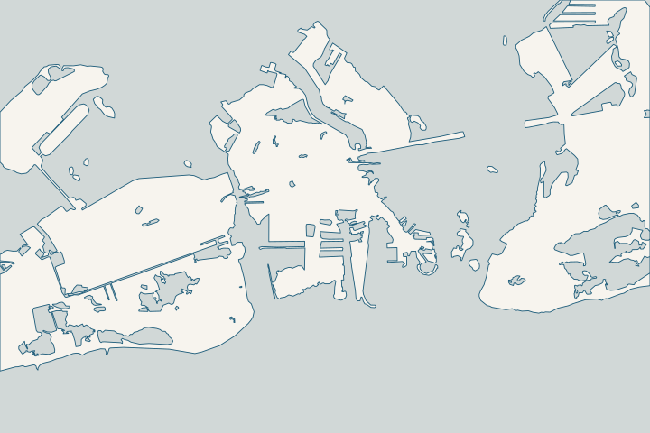
Stock Island at a glance
- Who permits it
- Monroe County for most parcels; confirm yours
- Call first
- County Stock Island office, 5503 College Road, (305) 295-3990
- The water
- Canals 478 (5th Ave) and 479 (12th Ave), 37 parcels
- Storm record
- Wilma: up to 4 ft of water in south-side homes
- Local rule to know
- Species review can apply; the Stock Island tree snail is covered
Get to know your waterfront
Stock Island is an unincorporated census place with less than one square mile of land and more water than land inside its boundary. Its waterfront mixes marinas and fishing facilities with water treatment and power plants, mobile home parks and housing. Only two residential canals appear in the county inventory. A Monroe County permitting office sits on the island at 5503 College Road.
2020 Census Gazetteer Files: Places, Florida · Monroe County Vulnerability Assessment Update & Compliance, Final Project Report (DEP Agreement No. 22PLN66) · Monroe County Residential Canals (Google Earth KMZ layer 'Residential_Canals_WGS', linked as 'Google Earth Document with Downloaded Canal Information') · Building and Permitting
Stock Island’s flood picture, from the canals to the shrimp docks
On Stock Island, the county’s main flood worry is storm surge. It names the whole island Hot Spot 8, facing surge impacts by 2040 because of low ground and open coastal exposure. County vulnerability assessment
The assets on that list show what kind of shoreline this is: water treatment plants, power generation, marinas, fishing facilities, mobile home parks and low-income housing. County vulnerability assessment
Start by confirming the permit office. The city’s floodplain page lists only “Stock Island (South Side)” as outside Key West, so check your parcel record. Key West floodplain page County permits run through OPAL, with an office on the island at 5503 College Road. County permit offices
Two residential canals
The county inventory lists only two Stock Island canals, both oceanside at mile marker 4. Canal 478 is tied to 5th Avenue and canal 479 to 12th Avenue, with 37 parcels between them. County canal inventory County canal street list
Both carry a “Good” water-quality label and a tide range field of about 0.8 ft. County canal inventory If your wall faces a marina basin or commercial dock instead, the marina bulkhead guide fits better.
What Wilma did here
In Wilma’s first surge, some homes on the south side of the island took up to 4 ft of water. In the second, sea water stood up to 3 ft deep in the residential streets of the Key West Golf and Country Club. NWS Key West Wilma summary
Streets on the county’s flood lists
- 58 Stock Island road segments, about 39,003 ft, are on the county’s list of its most critical roads. County critical roads list
- The Maloney subdivision alone has 26 of those segments and 586 homes; Shrimp Road adds 3,311 ft and 105 units. County critical roads list
- The road study’s 2025 group includes a 45,542-ft area covering Maloney, Sun Krest, Lincoln Gardens, Balido 1 and 2, Lincoln Manor Estates, Robyn, Sunshine and Shrimp Road. County road study
For scale, the county’s adopted projection adds 10 to 17 inches of sea level from 2000 to 2040, the year Hot Spot 8 looks to. County resiliency page
A species check owners do not expect
Fish and Wildlife review is not only a Big Pine matter. The FEMA Biological Opinion covers nine species across unincorporated Monroe County, including the Stock Island tree snail. County HCP transition boards
The federal species focus area maps decide if your lot is reviewed at all. If the county sends your application to the U.S. Fish and Wildlife Service, the county fee is $825. Monroe County code Ch. 122 Monroe Res. 277-2025
Working-waterfront paperwork
- The county requires a notarized Work Over the Water Notice for seawalls, docks and lifts, and warns that federal Longshore coverage may be needed. County Work Over the Water Notice
- On state-owned bottom, a dock built to moor ten or more vessels in Monroe County needs a submerged land lease. A seawall placed there, up to 3 ft waterward of mean high water, needs a letter of consent. Rule 18-21.005, F.A.C.
- For coral or seagrass near the wall, the sanctuary will not queue a project until plans, the state approval, a seafloor (benthic) survey and any federal approval are all in hand. Florida Keys sanctuary
What could the work cost?
A dock that moors ten or more vessels in Monroe County needs a state submerged land lease, so settle that before bidding a marina wall. Ask bidders to list barge access, Longshore coverage and any seafloor (benthic) survey as separate costs.
Calculator ranges come from a 2026 national cost guide and one Key West public bid. None is a quote; your written, itemized scope sets your price.
Compare quotes and plan a budget →Find the relevant permits and records
| Starting point | What to resolve | Prepare and look up |
|---|---|---|
Monroe County Building Department, Stock Island office | Building permits for seawall, dock and riprap work on unincorporated Stock Island. | 5503 College Road, Suite 203, (305) 295-3990. File through OPAL; paper is not accepted. |
Monroe County Planning & Environmental Resources | LDC review and the species focus area check that can send a permit to Fish and Wildlife. | Ask whether the parcel is on the focus area maps. (305) 289-2502; $825 fee if sent to FWS. |
Florida DEP Marathon branch | Exemptions, permits and state submerged-land consent or leases for marina and commercial shorelines. | Establish who owns the bottom before design. (305) 289-7070. |
Army Corps Keys Permits Section and Florida Keys National Marine Sanctuary | Federal authorization and sanctuary review when corals or seagrass may be affected. | Corps (305) 526-7181. Send the sanctuary a complete package, including a seafloor (benthic) survey, by email to fknms.authorizations@noaa.gov. |
A Stock Island planning checklist
These steps cover the questions that slow Stock Island jobs most often.
Confirm city or county
Key West names only the south side of Stock Island as outside the city. Check your parcel record before choosing an office.
Ask about species focus areas
Ask county environmental staff at (305) 289-2502 if your lot is on the federal species maps, which cover the Stock Island tree snail.
Environmental Resources · Habitat Conservation Plan transition presentation boards
Collect the over-water paperwork
Expect to sign the county’s Work Over the Water Notice. Ask your contractor for a certificate showing Longshore coverage, not just a promise.
Work Over the Water Notice · Rule 61G4-15.100, Certified Specialty Contractors
Verify the contractor’s license
Monroe County requires a Certificate of Competency in the trade. Call the Licensing Coordinator at (305) 289-2583 to check.
Plan your Stock Island seawall work
Tell us whether the wall faces a canal, a marina basin or open water, and what you have noticed since the last storm. We will help you decide what to do first.
Every answer here links to the public record behind it.
Stock Island project questions
Is Stock Island part of Key West?
Usually not, but check your parcel. The Census lists Stock Island as an unincorporated place, and the city’s floodplain page names “Stock Island (South Side)” as outside the city. Because the city named only the south side, confirm jurisdiction with the property appraiser before you file.
2020 Census Gazetteer Files: Places, Florida · Floodplain Management (FEMA)
Which Stock Island canals are residential?
The county inventory lists two: canal 478 on 5th Avenue and canal 479 on 12th Avenue, with 37 parcels between them. Both are oceanside at mile marker 4. Other waterfront on the island is mostly marinas and commercial docks.
Monroe County Residential Canals (Google Earth KMZ layer 'Residential_Canals_WGS', linked as 'Google Earth Document with Downloaded Canal Information') · Canal, Roads Names and Areas (List of Keys Residential Canals by location) · Monroe County Vulnerability Assessment Update & Compliance, Final Project Report (DEP Agreement No. 22PLN66)
How deep did Wilma flood Stock Island?
NWS reports some homes on the south side took up to 4 ft of water in Wilma’s first surge. In the second, water stood up to 3 ft deep in the streets of the Key West Golf and Country Club. Levels at any one lot depended on its ground height.
Why might a Stock Island permit go to Fish and Wildlife?
The FEMA Biological Opinion covers nine species across unincorporated Monroe County, including the Stock Island tree snail. If your parcel is in a species focus area and needs federal input, the county sends the application on and charges $825.
Habitat Conservation Plan transition presentation boards · Monroe County Land Development Code, Chapter 122 - Floodplain Management · Resolution No. 277-2025 (Building Department permitting fee schedule)
Keep planning
Nearby waterfront guides
Key West: New Town, Riviera Canal & Salt Ponds, Key Haven (Raccoon Key), Big Coppitt, Rockland & Geiger Key
Show sourcesHide sources
- 2020 Census Gazetteer Files: Places, FloridaSource reviewed 2026-10-28
- Monroe County Vulnerability Assessment Update & Compliance, Final Project Report (DEP Agreement No. 22PLN66)Source reviewed 2026-10-28
- Monroe County Residential Canals (Google Earth KMZ layer 'Residential_Canals_WGS', linked as 'Google Earth Document with Downloaded Canal Information')Source reviewed 2026-10-28
- Building and PermittingSource reviewed 2026-10-28
- Floodplain Management (FEMA)Source reviewed 2026-10-28
- Canal, Roads Names and Areas (List of Keys Residential Canals by location)Source reviewed 2026-10-28
- Hurricane Wilma (2005) event summarySource reviewed 2026-10-28
- Appendix K: Prioritization of Roadway Segments (Technical Memorandum, Dec. 29, 2020; Initial 25% Critical Roadways list dated 6/10/2021)Source reviewed 2026-10-28
- Monroe County Roadway Vulnerability Study Final Report (Table 2: Adaptation Plan List)Source reviewed 2026-10-28
- ResiliencySource reviewed 2026-10-28
- Habitat Conservation Plan transition presentation boardsSource reviewed 2026-10-28
- Monroe County Land Development Code, Chapter 122 - Floodplain ManagementSource reviewed 2026-10-28
- Resolution No. 277-2025 (Building Department permitting fee schedule)Source reviewed 2026-10-28
- Work Over the Water NoticeSource reviewed 2026-10-28
- Rule 18-21.005, F.A.C. (Forms of Authorization)Source reviewed 2026-10-28
- Nearshore Construction PermitsSource reviewed 2026-10-28
- Online Permitting ServicesSource reviewed 2026-10-28
- Environmental ResourcesSource reviewed 2026-10-28
- SED Marathon OfficeSource reviewed 2026-10-28
- Jacksonville District Regulatory Office LocationsSource reviewed 2026-10-28
- Rule 61G4-15.100, Certified Specialty ContractorsSource reviewed 2026-10-28
- Protect Yourself & OthersSource reviewed 2026-10-28