
Ramrod Key seawall repair
Most Ramrod Key canal lots share one waterway: county canal 350 serves 461 of the key’s 541 canal parcels. Its record lists defunct aerators and a 1982 culvert, and the Breezeswept Beach Estates roads beside it are on the county’s 2025 list.
Describe your project on this page ↓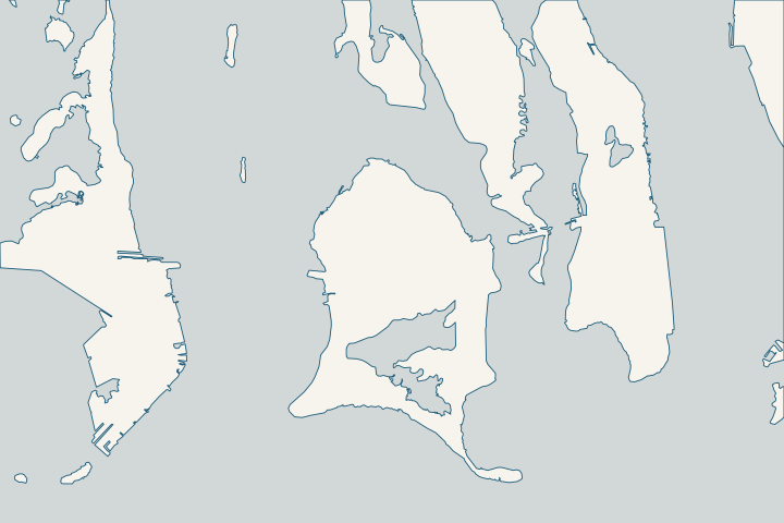
Ramrod Key at a glance
- Who permits it
- Monroe County; applications filed online in OPAL
- Call first
- County satellite office, 179 Key Deer Blvd, (305) 289-2877
- The water
- Canals 310, 311 and 350; canal 350 serves 461 parcels
- Storm record
- The Hurricane Center lists 5 to 6 ft of Georges surge at Ramrod (1998)
- Rock under the wall
- USGS maps a reef and oolite contact on south Ramrod
Get to know your waterfront
Ramrod sits at mile marker 27 with three county canals: 310, 311 and 350. Canal 350 runs about 6,000 feet past Indies Drive and lanes named for Caribbean islands, from Anguila to St Vincent. Beneath the key, USGS maps a change in rock type on its south side.
Monroe County Residential Canals (Google Earth KMZ layer 'Residential_Canals_WGS', linked as 'Google Earth Document with Downloaded Canal Information') · Canal, Roads Names and Areas (List of Keys Residential Canals by location) · Ramrod, Torch, and Big Pine Keys - Tile 5 (Professional Paper 1751)
What shapes a Ramrod Key seawall job
Canal 350: one system, 461 parcels
Canal 350 is the center of Ramrod’s waterfront. The county counts 461 parcels along roughly 6,000 feet of it, and its listed treatment reads "defunct aerators, 1982 culvert" in the county layer. County residential canal layer
Its streets include Indies Drive and lanes such as Antigua, Barbados, Cayman, Jamaica, Martinique and Tobago. County canal street list When this many lots share one canal, neighbors may share wall age and water access too. A joint assessment or bid is worth asking about; the neighbor group guide explains how.
Rock can change within one neighborhood
USGS places a geologic contact on the south part of Ramrod. There, the Key Largo reef rock of the Newfound Harbor Keys meets Miami Limestone, the cemented oolite that forms the Lower Keys. USGS Professional Paper 1751, Tile 5
Both formations wear a hard soilstone crust. USGS mapping is regional, so a boring or probe at your lot decides between driven sheet pile and a drilled or poured design. USGS regional geology
- Get a boring or probe at your wall line before you compare bids.
- Ask each bidder how the price changes if they hit rock or crust early.
- Expect the nearshore ledge, which USGS describes as submerged reef and oolite, to matter for riprap and dock pilings too.
USGS calls the Newfound Harbor Keys the westernmost emergent piece of the Key Largo reef. It also notes that the reef’s coral skeletons show in the walls of man-made canals. USGS regional geology If you can see coral texture in your canal wall, tell your engineer.
Where the sanctuary begins
The Florida Keys National Marine Sanctuary starts at the mean high-water mark, so a canal wall face sits right at its edge. Sanctuary boundary, 15 CFR 922 NOAA lists seawall repairs that could affect corals among the jobs needing sanctuary review. NOAA sanctuary permit page
With a reef and oolite ledge nearshore, ask your designer early if a seafloor (benthic) survey will be needed. It is easier to schedule one up front than to add it after the state and federal files are in.
Breezeswept roads in the 2025 group
The road study put Breezeswept Beach Estates, area 39 with 24,200 feet of road, in its 2025 adaptation group. Area 78, covering Silver Shores Estates and Ramrod Shores, joined it with 12,645 feet. County road study, Table 2
On the county’s critical list, 25 Breezeswept segments serve 291 residential units. Design any new cap with the future street grade in mind, and ask the county for current status first. County critical roads list
Storm water on Ramrod
- Georges, 1998: The Hurricane Center’s table lists 5 to 6 feet of surge for Ramrod Key. Hurricane Center Georges report, Table 2
- Irma, 2017: Ramrod lies inside the Cudjoe-to-Big Pine reach, where the Hurricane Center put inundation at 5 to 8 feet above ground level. Hurricane Center Irma report
Canals 310 and 311
Canal 310 serves Brown Drive, Lesrohde Drive and Mariposa Road, and canal 311 serves Coral Avenue. County canal street list On the 2021 ranking, 311 placed 38th for backfill only, and 310 placed 46th for a culvert, with a "Limited Data - Poor" note. County canal ranking list, 2021
The Torch Keys guide covers the island where USGS maps the same rock contact, and the Summerland Key guide covers the next key west. Every key is compared on the Lower Keys overview, and the permits page explains each agency’s role.
What could the work cost?
Rock is the big unknown on Ramrod. Ask every bidder to state what their price assumes about rock at the wall line, and get the boring done before you sign. On canal 350, ask whether neighbors on your reach want to share mobilization costs.
Calculator ranges come from a 2026 national cost guide and one Key West public bid. None is a quote; your written, itemized scope sets your price.
Compare quotes and plan a budget →Find the relevant permits and records
| Starting point | What to resolve | Prepare and look up |
|---|---|---|
Monroe County Building Department | The county permit for any wall, cap, riprap or dock job on Ramrod Key. | File in OPAL with digitally signed drawings. For in-person help, the county’s Big Pine Key satellite office is at 179 Key Deer Blvd, (305) 289-2877. |
Florida Keys National Marine Sanctuary | Review when wall, riprap or piling work could touch corals on the nearshore reef and oolite ledge. | Email plans, the state approval and a seafloor (benthic) survey to fknms.authorizations@noaa.gov. Incomplete files are not queued, and construction requests need at least 90 days. |
Florida DEP, Marathon branch | Exemption verification for canal seawall repair or replacement. | Ask for the written verification even if the county does not: the sanctuary counts it as the state approval. (305) 289-7070. |
U.S. Army Corps of Engineers, Keys Permits Section | Federal authorization; the county’s Notice to Proceed waits for it. | Call (305) 526-7181 and ask which permit has replaced SAJ-82, which expired June 24, 2026. |
A Ramrod Key planning checklist
Work through these before you sign anything for a Ramrod wall.
Confirm canal 350, 310 or 311
Look up your lane in the county street list. The Residential Canals map file shows the canal outline, so you can confirm which of the three you are on.
Canal, Roads Names and Areas (List of Keys Residential Canals by location) · Canal Restoration
Order a boring at the wall line
USGS maps reef rock and oolite meeting on south Ramrod. Only a lot-specific boring tells your engineer which one your wall stands in.
Ramrod, Torch, and Big Pine Keys - Tile 5 (Professional Paper 1751) · Regional Geologic Setting - Systematic Mapping of Bedrock and Habitats along the Florida Reef Tract (Professional Paper 1751)
Call about road area 39 or 78
Breezeswept is area 39; Silver Shores Estates and Ramrod Shores are area 78. Ask the county where each stands so your new cap and the future street grade work together.
Monroe County Roadway Vulnerability Study Final Report (Table 2: Adaptation Plan List)
Talk to the neighbors on your reach
With 461 parcels on canal 350, nearby owners may want to share an assessment, a survey or a bid.
Plan your Ramrod Key seawall repair
Share your lane, any cracks or sinking you have noticed, and whether a neighbor on canal 350 is planning work too. We can help you plan the job and the permits.
Every answer here links to the public record behind it.
Ramrod Key project questions
What is canal 350 on Ramrod Key?
It is the county number for the canal along Indies Drive and the lanes named for Caribbean islands. It serves 461 parcels along about 6,000 feet. The county records defunct aerators and a 1982 culvert there.
Monroe County Residential Canals (Google Earth KMZ layer 'Residential_Canals_WGS', linked as 'Google Earth Document with Downloaded Canal Information') · Canal, Roads Names and Areas (List of Keys Residential Canals by location)
Is Ramrod Key rock reef rock or oolite?
Both, depending on where you stand. USGS puts the contact between Key Largo reef rock and Miami Limestone oolite on the south part of Ramrod, and maps the shallow water around it as oolite. A boring at your wall line is the only way to know what your piles will meet.
Ramrod, Torch, and Big Pine Keys - Tile 5 (Professional Paper 1751)
Will the county raise the Breezeswept roads?
The county road study put Breezeswept, area 39, in its 2025 adaptation group with 24,200 feet of road. The study says that year reflects projected need, not a construction schedule or funding commitment. Ask the county for the current status.
Monroe County Roadway Vulnerability Study Final Report (Table 2: Adaptation Plan List)
How high has storm surge reached on Ramrod?
The Hurricane Center’s Georges report lists 5 to 6 feet of surge at Ramrod Key in 1998. Irma in 2017 brought 5 to 8 feet of water above ground across the reach from Cudjoe to Big Pine. These are storm-era estimates, not a design height.
Preliminary Report: Hurricane Georges (AL071998), 5 January 1999, updated 9 September 2014 · Tropical Cyclone Report: Hurricane Irma (AL112017), current version dated 8 July 2026
Keep planning
Nearby waterfront guides
Summerland Key, Little Torch & Middle Torch Key, Big Pine Key
Show sourcesHide sources
- Monroe County Residential Canals (Google Earth KMZ layer 'Residential_Canals_WGS', linked as 'Google Earth Document with Downloaded Canal Information')Source reviewed 2026-10-28
- Canal, Roads Names and Areas (List of Keys Residential Canals by location)Source reviewed 2026-10-28
- Ramrod, Torch, and Big Pine Keys - Tile 5 (Professional Paper 1751)Source reviewed 2026-10-28
- Regional Geologic Setting - Systematic Mapping of Bedrock and Habitats along the Florida Reef Tract (Professional Paper 1751)Source reviewed 2026-10-28
- 15 CFR 922.161 and Appendix I to Subpart P (Sanctuary boundary)Source reviewed 2026-10-28
- Nearshore Construction PermitsSource reviewed 2026-10-28
- Monroe County Roadway Vulnerability Study Final Report (Table 2: Adaptation Plan List)Source reviewed 2026-10-28
- Appendix K: Prioritization of Roadway Segments (Technical Memorandum, Dec. 29, 2020; Initial 25% Critical Roadways list dated 6/10/2021)Source reviewed 2026-10-28
- Preliminary Report: Hurricane Georges (AL071998), 5 January 1999, updated 9 September 2014Source reviewed 2026-10-28
- Tropical Cyclone Report: Hurricane Irma (AL112017), current version dated 8 July 2026Source reviewed 2026-10-28
- Monroe County Canal Restoration Ranking List (dated 06/16/2021; page footer 4/12/2021)Source reviewed 2026-10-28
- Online Permitting ServicesSource reviewed 2026-10-28
- Building and PermittingSource reviewed 2026-10-28
- PermitsSource reviewed 2026-10-28
- SED Marathon OfficeSource reviewed 2026-10-28
- Rule 62-330.051, F.A.C. (Exempt Activities)Source reviewed 2026-10-28
- Jacksonville District Regulatory Office LocationsSource reviewed 2026-10-28
- Regional General Permit SAJ-82Source reviewed 2026-10-28
- Notice To Proceed Instructional Handout (Internet Archive copy)Source reviewed 2026-11-05
- Canal RestorationSource reviewed 2026-10-28