Little Torch, Middle Torch and Big Torch Key seawall repair
The highest USGS high-water mark surveyed after Hurricane Irma was on Little Torch Key, about 5.5 feet above ground. If your wall took that water, check the cap, the fill behind it and the drains, not only the face.
Describe your project on this page ↓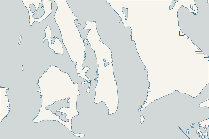
Little Torch & Middle Torch Key at a glance
- Who permits it
- Monroe County Building Department, via OPAL
- Call first
- County permitting help, (305) 294-4641
- The water
- Little Torch: 7 canals, 651 parcels. Big Torch: canal 262. Middle Torch: none listed
- Storm record
- Highest USGS Irma high-water mark: about 5.5 ft above ground, Little Torch
- Roads to watch
- Jolly Roger Estates and Mates Beach areas in the 2025 road group
Get to know your waterfront
The three Torch Keys share a name but not a waterfront. Little Torch has seven county canals at mile marker 29, five bayside and two oceanside, serving 651 parcels. Big Torch has one bayside canal, 262, with 67 parcels. The county lists no residential canals on Middle Torch.
Torch Keys seawall records: Irma, canals and roads
The Irma high-water mark on Little Torch
The highest USGS high-water mark surveyed after Irma stood on Little Torch Key: about 5.5 feet above ground, or about 6.7 feet NAVD88. Hurricane Center Irma report The official value is 5.45 feet above ground. Hurricane Center Irma report
Because this mark comes with a datum, your surveyor can set it beside your cap elevation in NAVD88. It is still one point, and water levels varied sharply from lot to lot.
the Hurricane Center’s broader estimate for this reach, Cudjoe east through Big Pine, was 5 to 8 feet above ground. Hurricane Center Irma report
Little Torch canals by street
| Canal | Streets |
|---|---|
279 to 281 | Astrangia Ave, Bayview Dr, Sea Whip St, Coral Shores Rd, Pine Channel Dr |
292 | Barry, Candice, Carolyn, Diane, Hecht, Meyer and Powell Avenues |
317 and 339 | Pirates, Blackbeard, Buccaneer, Doubloon, Tortuga, Maracaibo, Peg Leg and Jolly Roger Dr |
Confirm your parcel on the county canal map, because one street can border several canals. County canal street list
Canal 279 and the county restoration plan
Canal 279 ranked 22nd on the county’s 2021 list, and canal 281 ranked 60th. County canal ranking list, 2021 In 2024 the county asked for $100,000, as its priority 7, to design and permit muck removal, backfill, a culvert and an air curtain on 279. County 2024 Stewardship requests
If your wall is on 279, ask the county canal program about timing before you replace. Backfill raises the canal bottom, which changes the water depth at your wall toe.
Big Torch canal 262
Big Torch’s single canal, 262, is bayside and serves 67 parcels. County residential canal layer The 2021 ranking listed it 78th for backfill only, with a public estimate of about $8.3 million. County canal ranking list, 2021 That figure prices canal water-quality work and says nothing about the cost of a private wall.
Roads: Jolly Roger Estates, Mates Beach and Middle Torch
- Little Torch, 2025 group: area 37, Jolly Roger Estates, with 16,005 feet of road, and area 36-A, which includes Coral Shores Estates, Ladies Acre, the Mates Beach plats and Winward Beach Estates (6,704 feet). County road study, Table 2
- Little Torch, 2030 group: area 36-B, with 15,145 feet.
- Middle Torch: area 77, Dorns and Middle Torch Key Estates, about 7 miles of road. The study rates it more than a foot above projected 2025 and 2030 sea level, but within half a foot of projected king tides for 2025 to 2035. County road study, Table 2
Rock on the south side
USGS maps the Newfound Harbor Keys reef meeting oolite on the south parts of Ramrod and Torch Keys. The shallow bottom around Torch is oolite, and reef and oolite together form the nearshore ledge. USGS Professional Paper 1751, Tile 5
Ask for a probe or boring before you pick a pile method. For permit steps, see permits; for the neighbors, see the Ramrod Key and Big Pine Key guides or the Lower Keys overview.
What could the work cost?
If you raise your cap, the fill behind it and the drains change too. Ask bidders to price cap, backfill and drainage separately. Have each state the finished cap elevation in NAVD88, so you can set it beside the Irma mark of about 6.7 feet.
Calculator ranges come from a 2026 national cost guide and one Key West public bid. None is a quote; your written, itemized scope sets your price.
Compare quotes and plan a budget →Find the relevant permits and records
| Starting point | What to resolve | Prepare and look up |
|---|---|---|
Monroe County Building Department | Building permit for seawall, dock or riprap work on Little, Middle or Big Torch. | Apply in OPAL. Permit questions: permittinghelp@monroecounty-fl.gov or (305) 294-4641. |
Monroe County Planning & Environmental Resources | county code 118-12 shoreline review, plus dock rules when a dock ends over seagrass or hardbottom. | A dock ending over seagrass needs at least 4 feet of water above it at mean low water, with benthic and bathymetric surveys. Environmental Resources: (305) 289-2502. |
Florida DEP, Marathon branch | State exemption or permit, and written consent for a new dock over state-owned bottom. | Find out first if your canal bottom is private or state-owned; Monroe County is outside the state’s no-application consent for new docks. (305) 289-7070. |
U.S. Army Corps of Engineers, Keys Permits Section | Federal sign-off for anything built or repaired in the water. | SEAppls@usace.army.mil or (305) 526-7181. |
Florida Keys National Marine Sanctuary | Review where wall, riprap or dock work may affect seagrass or coral. | Seagrass surveys must fall between June 1 and September 30 and be done by a biologist holding a sanctuary permit. Plan around that window. |
A Torch Keys seawall checklist
Start with the cap elevation, then line up the canal, road and survey questions.
Compare your cap with the Irma mark
Ask your surveyor for your cap elevation in NAVD88 and set it beside the Little Torch mark of about 6.7 feet NAVD88.
Check canal 279’s schedule
If you are on canal 279, ask the county canal program where the design stands before you replace. The program’s page lists (305) 453-8774.
Water Quality Protection and Canal Restoration in the Florida Keys ACSC: DEP Stewardship Funding Portal Project Requests · Canal Restoration
Book the seagrass survey window
If dock or riprap work reaches seagrass, the sanctuary survey must happen between June 1 and September 30.
Resource Assessment Survey Protocols for Nearshore Construction Projects
Ask about Jolly Roger Estates and Mates Beach roads
Areas 37 and 36-A are in the county’s 2025 road group. Get their status before you choose a cap height.
Monroe County Roadway Vulnerability Study Final Report (Table 2: Adaptation Plan List)
Plan your Torch Keys seawall project
Tell us which Torch Key you are on, your canal or street, and what Irma or a recent tide did at your wall. We will help you work out what to do first.
Every answer here links to the public record behind it.
Little Torch & Middle Torch Key project questions
How high did Irma’s water reach on Little Torch Key?
The highest USGS high-water mark surveyed after Irma was on Little Torch: 5.45 feet above ground, about 6.7 feet NAVD88. Water levels varied lot by lot, so treat it as one measured point, not your wall’s design height.
Tropical Cyclone Report: Hurricane Irma (AL112017), current version dated 8 July 2026 · Tropical Cyclone Report: Hurricane Irma (AL112017)
Does Middle Torch Key have county canals?
The county canal layer lists no residential canals on Middle Torch. Its one data point is road area 77, Dorns and Middle Torch Key Estates, rated within half a foot of projected 2025 to 2035 king tides.
Monroe County Residential Canals (Google Earth KMZ layer 'Residential_Canals_WGS', linked as 'Google Earth Document with Downloaded Canal Information') · Monroe County Roadway Vulnerability Study Final Report (Table 2: Adaptation Plan List)
Which canal serves Jolly Roger Drive?
The county ties canals 317 and 339 to the pirate-named roads, including Jolly Roger Drive, Buccaneer, Doubloon and Peg Leg. Jolly Roger Estates roads are also area 37 in the county’s 2025 road group.
Canal, Roads Names and Areas (List of Keys Residential Canals by location) · Monroe County Roadway Vulnerability Study Final Report (Table 2: Adaptation Plan List)
Is Big Torch canal 262 being backfilled?
Canal 262 appears 78th on the 2021 ranking for backfill only, with a public estimate of about $8.3 million. A ranking is not a schedule, and the county has said it is redoing the list with fresh dissolved-oxygen readings. Ask the canal program for current status.
Monroe County Canal Restoration Ranking List (dated 06/16/2021; page footer 4/12/2021)
Keep planning
Nearby waterfront guides
Show sourcesHide sources
- Monroe County Residential Canals (Google Earth KMZ layer 'Residential_Canals_WGS', linked as 'Google Earth Document with Downloaded Canal Information')Source reviewed 2026-10-28
- Tropical Cyclone Report: Hurricane Irma (AL112017)Source reviewed 2026-10-28
- Canal, Roads Names and Areas (List of Keys Residential Canals by location)Source reviewed 2026-10-28
- Monroe County Canal Restoration Ranking List (dated 06/16/2021; page footer 4/12/2021)Source reviewed 2026-10-28
- Water Quality Protection and Canal Restoration in the Florida Keys ACSC: DEP Stewardship Funding Portal Project RequestsSource reviewed 2026-10-28
- Monroe County Roadway Vulnerability Study Final Report (Table 2: Adaptation Plan List)Source reviewed 2026-10-28
- Ramrod, Torch, and Big Pine Keys - Tile 5 (Professional Paper 1751)Source reviewed 2026-10-28
- Online Permitting ServicesSource reviewed 2026-10-28
- Monroe County Land Development Code, Chapter 118 - Environmental ProtectionSource reviewed 2026-10-28
- Environmental ResourcesSource reviewed 2026-10-28
- SED Marathon OfficeSource reviewed 2026-10-28
- Rule 18-21.005, F.A.C. (Forms of Authorization)Source reviewed 2026-10-28
- Jacksonville District Regulatory Office LocationsSource reviewed 2026-10-28
- Resource Assessment Survey Protocols for Nearshore Construction ProjectsSource reviewed 2026-10-28
- Nearshore Construction PermitsSource reviewed 2026-10-28
- Canal RestorationSource reviewed 2026-10-28