Cudjoe Key seawall repair after Irma
Hurricane Irma made landfall near Cudjoe Key on Sept. 10, 2017, as a Category 4 storm. The National Hurricane Center found 5 to 8 feet of water above ground from Cudjoe east to Big Pine. Monroe County permits seawall work here.
Describe your project on this page ↓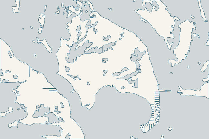
Cudjoe Key & Cudjoe Gardens at a glance
- Who permits it
- Monroe County Building Department; Cudjoe is unincorporated
- Call first
- County satellite office on Big Pine Key, (305) 289-2877
- The water
- 46 canal sections, 45 oceanside, 1,503 parcels
- Storm record
- Irma landfall Sept. 10, 2017; 5 to 8 ft above ground from Cudjoe east
- Roads to watch
- Cutthroat Harbor Estates area in the 2025 road adaptation group
Get to know your waterfront
Cudjoe Key is slightly more water than land: its census area holds about 5.3 square miles of water against 5.2 of land. The county lists 46 residential canal sections here, numbered 312 to 380 between mile markers 21 and 23. All but one are on the ocean side, and together they front 1,503 parcels.
2020 Census Gazetteer Files: Places, Florida · Monroe County Residential Canals (Google Earth KMZ layer 'Residential_Canals_WGS', linked as 'Google Earth Document with Downloaded Canal Information')
Cudjoe Key seawall records: storms, canals and roads
Irma drew a line through Cudjoe. From west of Cudjoe to Key West, flooding ran 2 to 4 feet above ground. From Cudjoe east to Big Pine, it ran 5 to 8 feet. Hurricane Center Irma report
Storm figures recorded at Cudjoe
| Storm | What was recorded |
|---|---|
Irma, Sept. 10, 2017 | Landfall near Cudjoe as a Category 4 hurricane, maximum winds 115 knots Hurricane Center Irma report |
Irma, Sept. 10, 2017 | 5 to 8 feet of water above ground from Cudjoe east to Big Pine and Bahia Honda Hurricane Center Irma report |
Georges, 1998 | Storm surge of 5 to 6 feet at Cudjoe Key Hurricane Center Georges report, Table 2 |
None of these numbers is a cap height. Irma figures are depth above ground, while the Georges surge is height above the normal tide. Hurricane Center Georges report Ask your engineer to convert any of them to the datum on your survey, and see the storm guide for how datums differ.
Find your canal by street
The county ties each street to canal numbers. Use the number when you talk to the county, a surveyor or a bidder. County canal street list
- Spanish Main Drive: 18 canals.
- Puerto Bello Drive: nine canals, numbered 371 to 380.
- 1st through 9th Avenues and Drost Drive: canals 329 to 344.
- Pirate-named lanes such as Blackbeard, Cutlass, Doubloon, Galleon, Drake, Teach and Hawkins: the remaining canals.
What the county layer says about Cudjoe canals
The county rates 19 of the 46 sections "Poor" for water quality, 17 "Fair" and 8 "Good" in its layer. Tidal range fields run from about 0.8 to 1.2 feet. County residential canal layer
The same layer records hardware already in the water. Culverts run under 2nd and 4th Avenues and Drost Drive on canal 329. Canal 355 has a bubble curtain and aerator, and the bubble curtain on canal 373 is marked as no longer working. County canal layer, existing treatments
The layer also carries weed-gate and backfill columns, but the file never says whether a "yes" means installed or recommended. Ask the county before you assume either. County residential canal layer
Canal projects on the county list
- Canal 372: ranked 42nd in 2021 for a weed gate, estimated at $100,000.
- Canal 349: ranked 45th, about $1.3 million.
- Canal 355: ranked 48th, about $7.1 million.
- Canal 373: ranked 52nd, about $2 million.
These are public water-quality estimates, and the county is re-ranking canals with new oxygen data. They are not seawall prices. County canal ranking list, 2021
Cutthroat Harbor Estates and the road plan
Cudjoe has 57 road segments, about 21,665 feet, on the county’s most-critical list. Cutthroat Harbor Estates holds 30 of them, serving 265 residential units. County critical roads list
The road study placed area 45-A, covering Cutthroat Harbor Estates, its 1st Addition and Cudjoe Ocean Shores, in its 2025 adaptation group. That is a planning year, not a construction date. County road study, Table 2
Before you set a new cap height in those neighborhoods, ask the county where the road design stands. A cap and a street planned together usually drain better than ones set years apart.
After a storm, debris help is not wall help
After Irma, the county used $49.2 million in federal NRCS money, plus $10 million of its own, to clear canal debris and sediment. Of 422 canals submitted for debris removal, 247 were approved. The program cleaned waterways; it did not rebuild private walls. County NRCS debris paper
Treat the wall as an owner cost, and read the insurance guide for why flood policies leave seawalls out. Open-water frontage plays by a stricter rule than canal frontage: county code allows no new vertical seawall on open water. Monroe County county code 118-12(k)(3)
The permit guide walks through the county, state and federal steps. For neighbors, see the Sugarloaf Key and Summerland Key guides, or compare every key on the Lower Keys overview.
What could the work cost?
The post-Irma canal cleanup paid for debris and sediment, not private seawalls, so plan the wall as your own cost. Ask each bidder to list the cap, the toe, backfill and water-side access as separate lines. Add the county’s $976 Notice to Proceed fee when the permit waits on state or federal approval.
Calculator ranges come from a 2026 national cost guide and one Key West public bid. None is a quote; your written, itemized scope sets your price.
Compare quotes and plan a budget →Find the relevant permits and records
| Starting point | What to resolve | Prepare and look up |
|---|---|---|
Monroe County Building Department | The building permit for seawall, cap, riprap or dock work on Cudjoe Key, an unincorporated census place. | Apply online through OPAL; paper is not accepted. Questions: (305) 294-4641 or permittinghelp@monroecounty-fl.gov. In person: Big Pine Key satellite office, 179 Key Deer Blvd, (305) 289-2877. |
Florida DEP, Marathon branch | State exemption or permit, and any use of state-owned bottom. | One drawing with the old and new wall lines. Repair in a legally existing residential canal can qualify for a state exemption; ask for written verification. (305) 289-7070. |
U.S. Army Corps of Engineers, Keys Permits Section | Federal authorization for work in the water. The county will not issue its Notice to Proceed without it. | The same drawings as the DEP file. Ask which permit now covers Keys seawalls, since regional permit SAJ-82 expired June 24, 2026. (305) 526-7181. |
Florida Keys National Marine Sanctuary | Review when wall or riprap work on an oceanside canal could affect corals or other seabed life. | Plans, the state approval and a seafloor (benthic) survey, emailed to fknms.authorizations@noaa.gov at least 90 days before the start date you want. |
A Cudjoe Key seawall checklist
Four things a Cudjoe owner can do this week, before calling a single bidder.
Pin down your canal number
Find your street on the county canal list, then confirm the number on the county’s Residential Canals map file. Spanish Main Drive alone touches 18 canals.
Canal, Roads Names and Areas (List of Keys Residential Canals by location) · Canal Restoration
Pull both permit files
Permits filed since October 1, 2022 live in OPAL. Older ones sit in the county’s legacy paper system, so ask for both when you check your wall’s history.
Ask about area 45-A
In Cutthroat Harbor Estates, its 1st Addition or Cudjoe Ocean Shores, ask the county where the road design stands before you choose a cap height.
Monroe County Roadway Vulnerability Study Final Report (Table 2: Adaptation Plan List)
Read the Work Over the Water notice
The county requires a notarized notice, signed by you and the contractor, for seawall and dock work from boats or barges. Ask for proof of federal longshore coverage, because an owner can be liable if it is missing.
Plan your Cudjoe Key seawall repair
Send your street or canal number, a note on the cap and toe, and whether the wall has been repaired since Irma. We will help you sort out the next step.
Every answer here links to the public record behind it.
Cudjoe Key & Cudjoe Gardens project questions
Did Irma really come ashore at Cudjoe Key?
Yes. The National Hurricane Center estimates Irma made landfall near Cudjoe Key on Sept. 10, 2017, as a Category 4 hurricane with 115-knot winds. Its report puts flooding at 5 to 8 feet above ground from Cudjoe east to Big Pine.
Tropical Cyclone Report: Hurricane Irma (AL112017), current version dated 8 July 2026
Which canal is behind my house on Cudjoe?
The county street list links Spanish Main Drive to 18 canals and Puerto Bello Drive to canals 371 to 380. The numbered avenues and Drost Drive sit on canals 329 to 344. One street can touch several canals, so confirm your parcel on the county map.
Canal, Roads Names and Areas (List of Keys Residential Canals by location)
Will county canal restoration fix my seawall?
No. Canal restoration targets water quality with culverts, backfilling, organic removal and air curtains. The county’s cost figures are for that public work, not for private walls, which stay the owner’s job.
Water Quality Protection and Canal Restoration in the Florida Keys ACSC: DEP Stewardship Funding Portal Project Requests · Monroe County Canal Restoration Ranking List (dated 06/16/2021; page footer 4/12/2021)
Are Cutthroat Harbor Estates roads being raised?
The county road study placed area 45-A, including Cutthroat Harbor Estates, its 1st Addition and Cudjoe Ocean Shores, in its 2025 adaptation group. The study says that year marks projected need, not a construction schedule or funding. Ask the county for current status.
Monroe County Roadway Vulnerability Study Final Report (Table 2: Adaptation Plan List)
Keep planning
Nearby waterfront guides
Summerland Key, Sugarloaf Key & Sugarloaf Shores, Ramrod Key
Show sourcesHide sources
- 2020 Census Gazetteer Files: Places, FloridaSource reviewed 2026-10-28
- Monroe County Residential Canals (Google Earth KMZ layer 'Residential_Canals_WGS', linked as 'Google Earth Document with Downloaded Canal Information')Source reviewed 2026-10-28
- Tropical Cyclone Report: Hurricane Irma (AL112017), current version dated 8 July 2026Source reviewed 2026-10-28
- Preliminary Report: Hurricane Georges (AL071998), 5 January 1999, updated 9 September 2014Source reviewed 2026-10-28
- Canal, Roads Names and Areas (List of Keys Residential Canals by location)Source reviewed 2026-10-28
- Monroe County Canal Restoration Ranking List (dated 06/16/2021; page footer 4/12/2021)Source reviewed 2026-10-28
- Appendix K: Prioritization of Roadway Segments (Technical Memorandum, Dec. 29, 2020; Initial 25% Critical Roadways list dated 6/10/2021)Source reviewed 2026-10-28
- Monroe County Roadway Vulnerability Study Final Report (Table 2: Adaptation Plan List)Source reviewed 2026-10-28
- NRCS Emergency Watershed Protection Program for Disaster-Related Marine Debris Removal: Monroe County's Experience, Needs and RecommendationsSource reviewed 2026-10-28
- Monroe County Land Development Code, Chapter 118 - Environmental ProtectionSource reviewed 2026-10-28
- Online Permitting ServicesSource reviewed 2026-10-28
- Building and PermittingSource reviewed 2026-10-28
- SED Marathon OfficeSource reviewed 2026-10-28
- Rule 62-330.051, F.A.C. (Exempt Activities)Source reviewed 2026-10-28
- Jacksonville District Regulatory Office LocationsSource reviewed 2026-10-28
- Regional General Permit SAJ-82Source reviewed 2026-10-28
- Nearshore Construction PermitsSource reviewed 2026-10-28
- PermitsSource reviewed 2026-10-28
- Canal RestorationSource reviewed 2026-10-28
- Work Over the Water NoticeSource reviewed 2026-10-28
- Water Quality Protection and Canal Restoration in the Florida Keys ACSC: DEP Stewardship Funding Portal Project RequestsSource reviewed 2026-10-28